What We Do
Aerial imaging solutions for construction, events, real estate, and beyond.
Primary Service
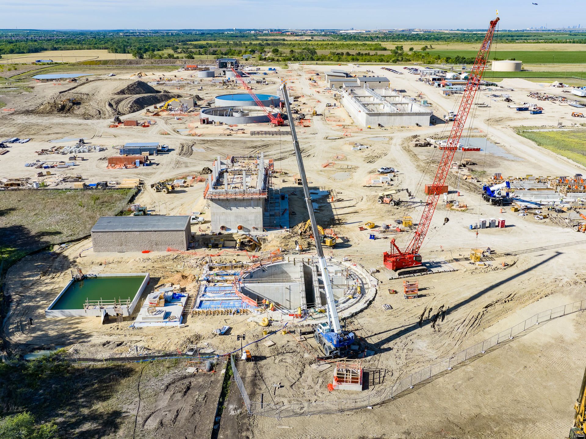
Construction projects are dynamic, complex, and expensive — and aerial documentation is one of the most powerful tools in a project manager's toolkit. Accent Aerial Photography has been documenting major construction projects across Central Texas since 2009.
From groundbreaking to grand opening, we provide regularly scheduled aerial photography and video that captures progress, supports project reporting, documents site conditions, and creates a permanent visual record of your project.
Signature Specialty
Our 360° interactive aerial panoramas are unlike anything else we offer — and unlike anything most clients have seen before. Captured by drone at altitudes up to 400 feet, these fully immersive panoramas let viewers look in every direction, zoom into fine detail, and jump between multiple vantage points.
We've used this technology for Austin high-rise developers to visualize what future residents will see from every floor — before a single beam is placed. It's a powerful sales and design tool that transforms how clients understand a site.
Events & Entertainment
Some events can only truly be appreciated from above. Accent Aerial Photography has been providing official aerial coverage for major Central Texas events for well over a decade — including every Rodeo Austin since 2013.
We understand event environments: tight windows, complex logistics, and the need to capture the moment when it happens. Our experience in dynamic, time-sensitive situations means you can trust us to deliver.
Real Estate
When a property needs to be seen in its full context — its relationship to the surrounding land, neighborhood, water features, and access points — aerial photography delivers what ground-level simply cannot. We specialize exclusively in aerial imagery, bringing focused expertise and exceptional quality to every real estate shoot.
Whether it's a luxury residential listing, a commercial property, a large acreage tract, or a new development, our aerial photography gives your listing a perspective that stops buyers mid-scroll.
Zoom in and drag to explore · Go full screen for maximum detail
Inspection & Mapping
Drone technology has transformed aerial inspection and mapping — providing safer access to difficult areas and significantly reducing time and cost compared to traditional methods. We provide photogrammetry mapping and visual inspection services for a wide range of commercial and infrastructure applications.
Beyond Drone Limits
Standard drone operations are limited to 400 feet above ground level — but some projects demand a higher vantage point. For those assignments, we supplement our drone services with full-scale manned helicopter photography, providing the altitude and range that certain projects require.
This seamless combination of drone and helicopter capability means we can handle virtually any aerial imaging challenge, at any altitude, anywhere in Texas.
Inquire About Helicopter Services